Tag Archives: Hiking Spree

Hiking Spree 2018

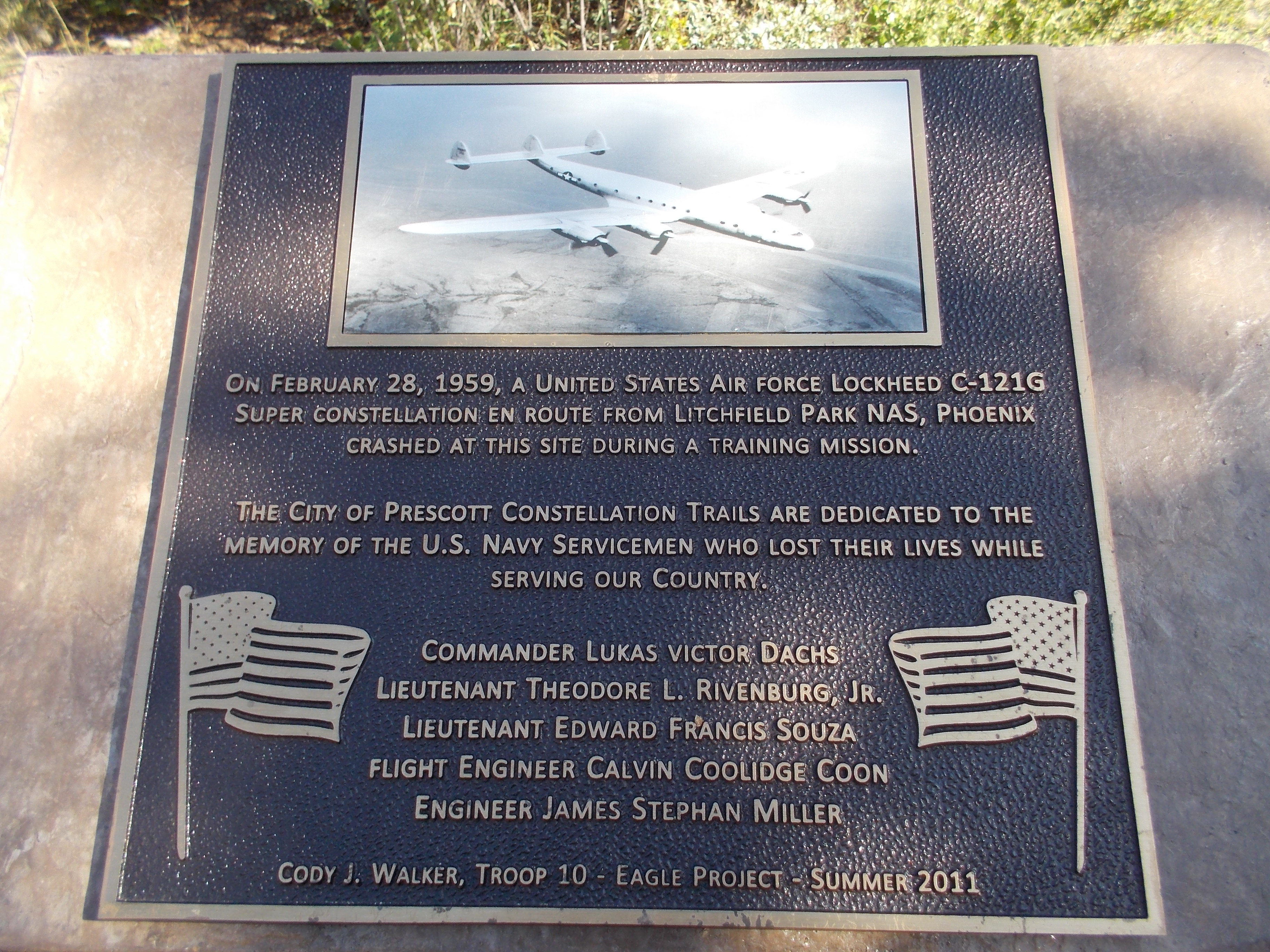
The Highlands Center for Natural History began offering the Hiking Spree in 2008. In recognition for ten years of hiking, this year’s spree includes ten hikes from previous years and two new hikes. Maps for all eleven hiking sprees are available on the Highlands Center website.

One of the new hikes is in an area called Storm Ranch.  Like the Constellation Trail, Storm Ranch is a large loop trail with smaller loops within it. It is accessed from the Peavine Trail, which you may already be familiar with. The parking lot for the Peavine Trail is off of Prescott Lakes Parkway on Sundog Ranch Road. Once you reach the Peavine Trailhead, hike north for about two miles to Boulder Creek. If you have a bike, you can ride it to the Storm Ranch area and lock it in the bike rack. The Boulder Creek Trail will be on your right (not the lake side of the trail).

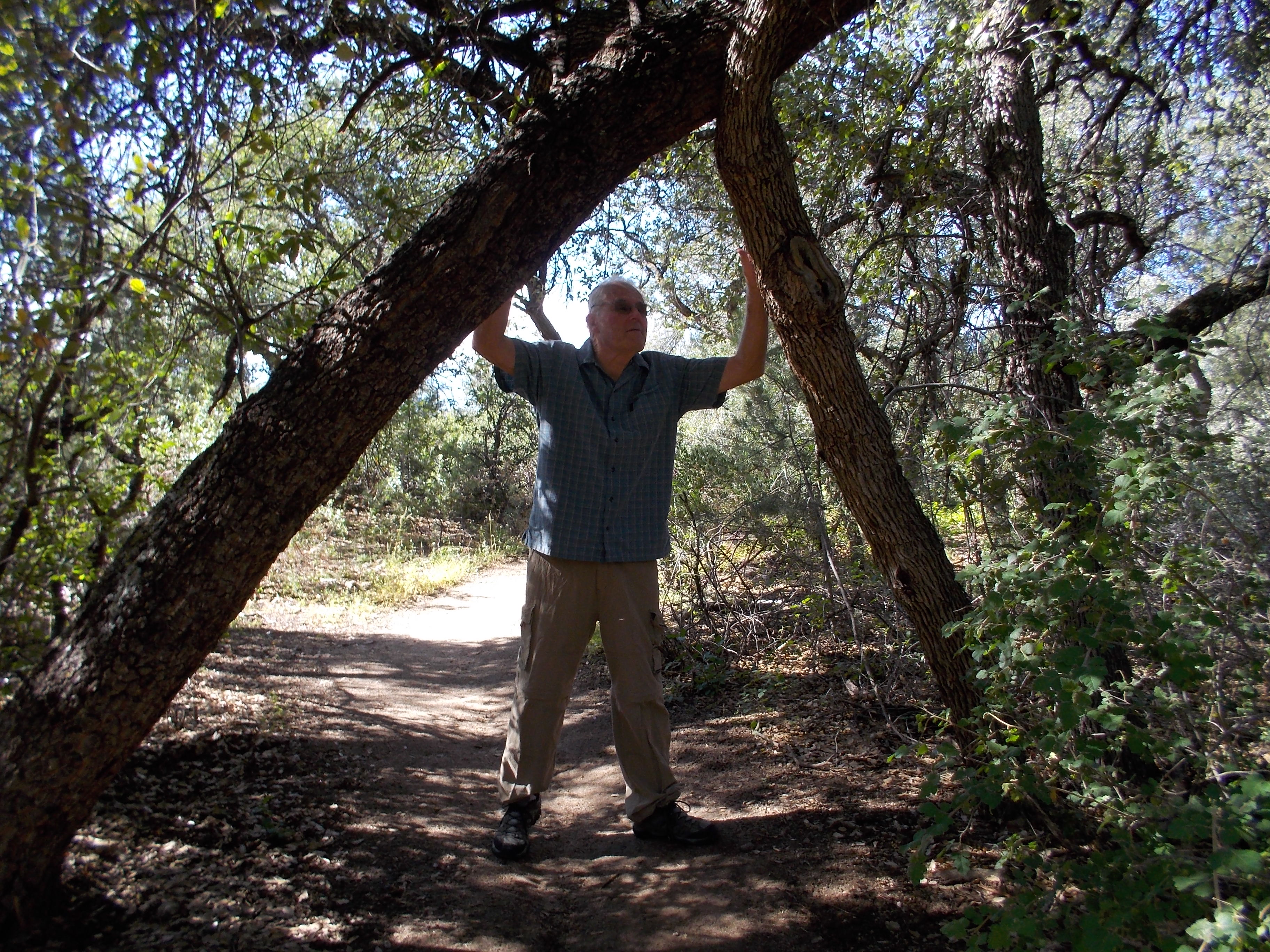
Boulder Creek is usually dry, but two days before my hike we received quite a bit of rain from Huricane Rosa. It was delightful to hike along a gurgling stream—a rare experience in Arizona.

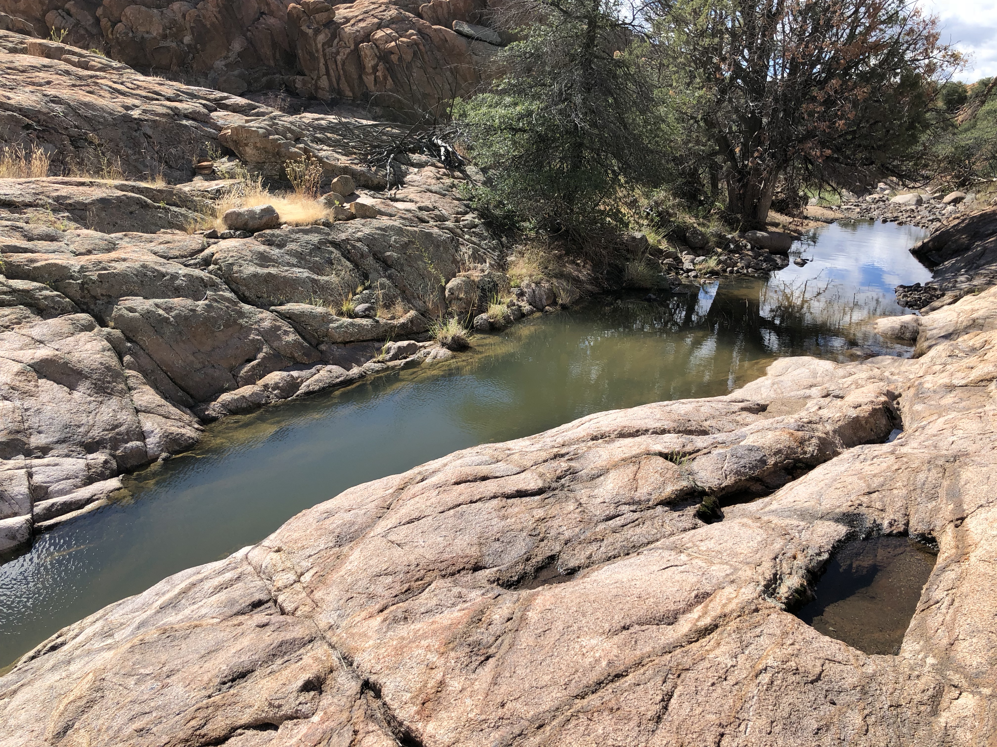
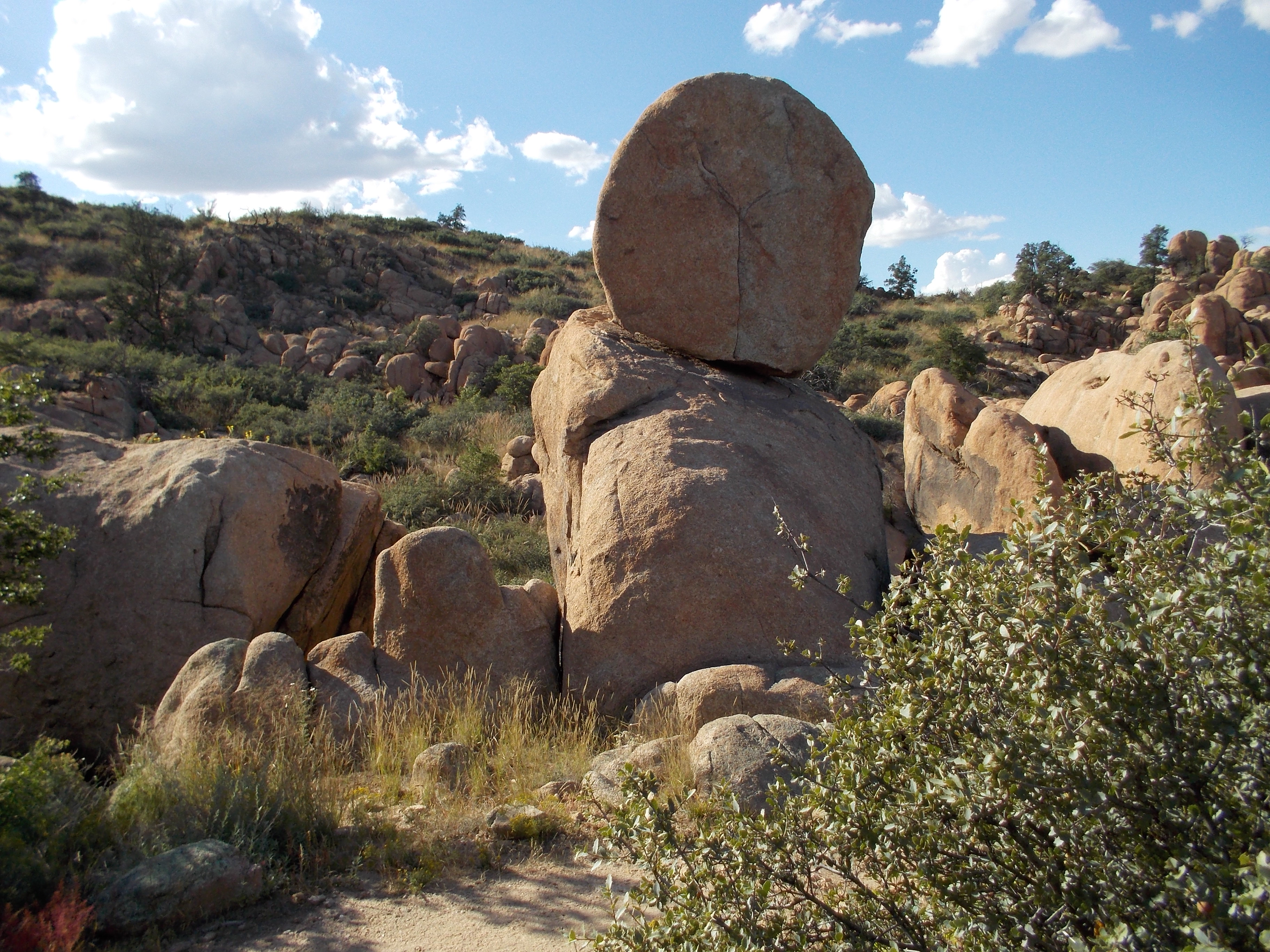
The Hiking Spree hike included a half-mile of the Boulder Creek Trail and three-fourths of a mile through a section named Easter Island because the rock formations look like statues.  I decided to explore some of the additional trails. So I continued through Dino Canyon to the Bedrock City Trail. I never saw any dinosaurs, but that doesn’t mean they were never there.

As I was running out of time, I took the Pebbles Trail as a shortcut back. (Further up was BamBam Trail, another shortcut.) This led me to Quartz Canyon. I was at a loss to understand how it got that name as all I was seeing was granite. Then I noticed a ribbon of quartz running through the granite and decided that was what the trail was named for. Boy! was I wrong! Suddenly I found myself in an area full of quartz–large and small.  
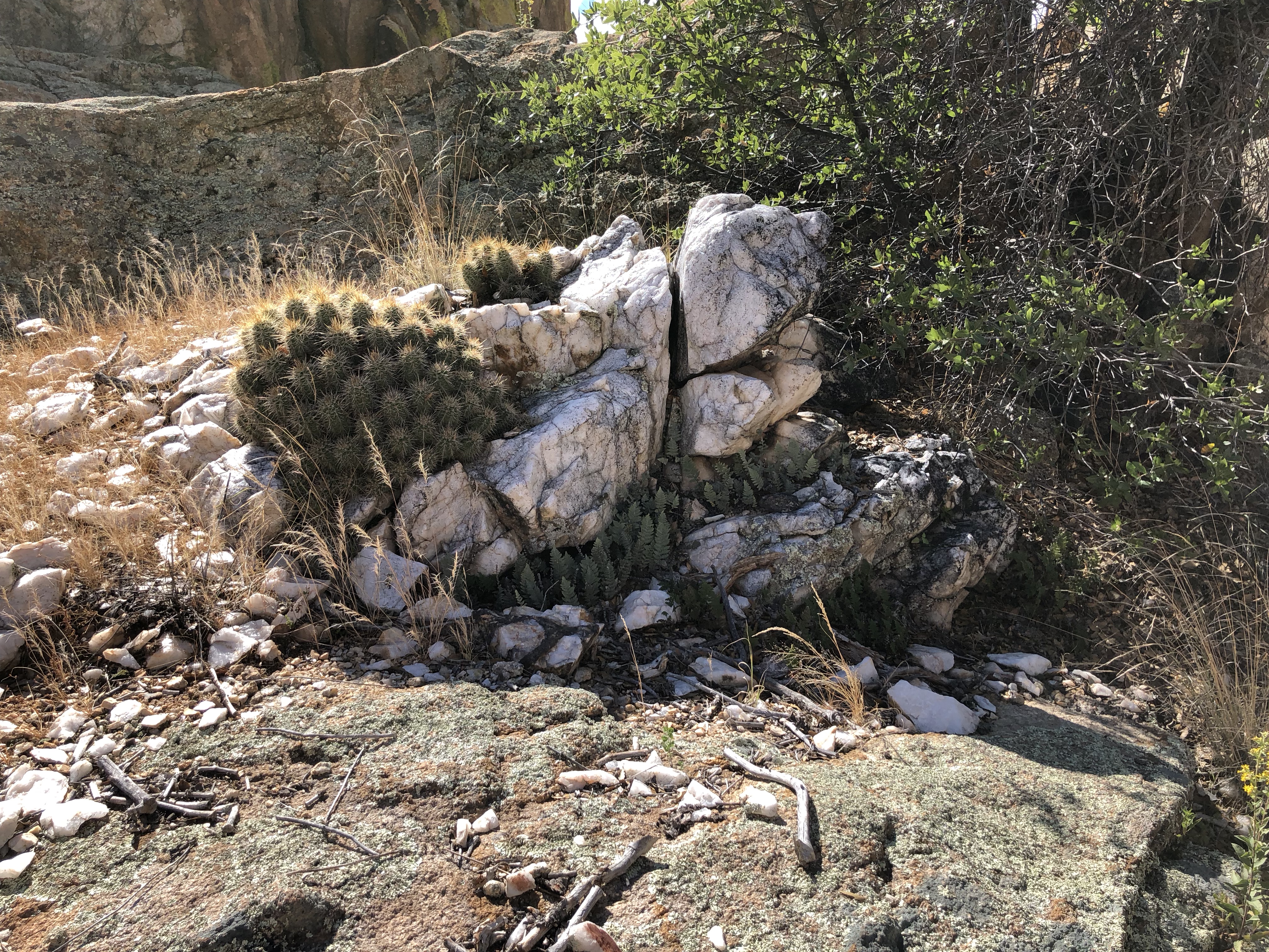
From there, I reached the Easter Island Trail that would take me back to the Peavine.

I hope to go back again and try some of the other trails I didn’t get to on this hike, and new ones as they are completed. By the time I finished my hike, I had covered about six miles. It took me a while to recover from the strenuous hike, but it took me even longer to get the Flinstones theme song out of my head.

Hiking Spree 2017 is underway!

This is the tenth year of the Hiking Spree. With twelve hikes to choose from for each year, that’s 120 hikes in or near Prescott, AZ! You can get maps for all the hikes at the Highlands Center for Natural History website.

I’m hiking alone this year, as my husband is no longer able to make the treks with me. And since my time away from home is limited, I’m taking the shorter hikes. That doesn’t mean they aren’t spectacular. That was the case with Willow Lake, north. I thought I had explored all of the trails around Willow Lake, but apparently, this is a new one. Although I had a map with me and there are maps posted periodically, I still managed to miss the trail.  To help assure that you don’t miss it, I took this picture to show the white dots. When you reach the end of the approach trail, follow the dot on the left. Bear left as you proceed across the granite rock. Soon you will find yourself in a secluded canyon. Following the Canyon Trail a short distance, you will come to the Apex Trail.  It is a short, steep trail that will give you great views. Returning to the Canyon Trail, proceed to the James Trail, another short trip to another great view.

One great feature of the Canyon trail is that It is flatter than most of the trails in Willow Lake. The entire loop is only two miles but it is an amazing hike!

It’s hikin’ time again in Prescott, AZ

dscn0317The 2016 Hiking Spree is underway at the Highlands Center for Natural History. For our third hike, we chose the spectacular Constellation Trail. It is located at the site of the 1959 crash of a Lockheed Constellation. A memorial to the five men who died there can be found atdscn0301 the beginning of the trail as well as pieces of the wreckage.

dscn0302

The trail is west of Highway 89, just south of Highway 89-A. You can park in the lower parking lot at Phippen Museum and use the tunnel to go under Highway 89.  The Constellation is actually made up of small loops inside a large loop. This allows hikers to plan short and long hikes. But you’ll want to allow plenty of time. No matter what my plans, I always end up spending more time than I expect. I get caught up in the wonder of it all.

dscn0304It had rained hard the day before leaving water along the way, but most of the trail was dry.  We began our hike on the North 40, which goes along the base of the large granite formations. Then we took a newly added loop called Ham and Cheese. The trail wove through the granite rocks as if they were made of Swiss cheese, making us feel like we were part of the sandwich–Does that mean the hikers are the ham?dscn0310 Next we took a trail called the Hully Gully. A walk across the face of granite rocks (the Hully) led us to a flower-lined gully.  Our next leg of the hike was the Lost Wall. This part was steeper than the other parts of our hike. I was envious of the lizards that made it seem so easy to go  up the granite boulders. But then they do have four feet instead of two and a much lower center of gravity.

dscn0318The lost wall is part of what was probably a sheep pen,  built more than one hundred years ago.  We skipped the Hole in the Wall loop that goes steeply up through a crack between the rocks. We have done that trail before and it is a fun one. Returning back to the trailhead via the Rock Wall Trail, we were treated to picturesque views of the Dells along with unbelievable rock formations.dscn0322

I hope you have the opportunity to explore this amazing trail. Don’t rush–You’ll want to stop often to enjoy the scenery that makes hiking the Granite Dells a unique experience.


Hiking Spree 2015

IMG_0927On Sunday, Craig and I finished our eighth and final hike to complete the Hiking Spree for this year. As it was a cold, cloudy day, we chose an easy 1.7 mile hike at Thumb Butte. Driving there, I felt a little bit of de ja vu, recalling the last time we had hiked that trail. It was the first year of the Hiking Spree, and time was running out. We needed to complete two hikes in one day. The choices of hikes included two at Thumb Butte, so we decided to kill two birds with one stone so to speak. It was a cold, cloudy day, much like last Sunday but we were undaunted by the weather.

Reaching Thumb Butte, we decided take the hike to the top first in   IMG_0466case the weather went bad. The rain began just as we started up the trail. As we continued, we encountered hikers running down the trail, but we were the only ones still going up. That should have been a clue, but we pressed on. Soon the rain changed to snow. Thunder and lightning was all around us as we struggled to reach the top of the mountain, hoping we would be sheltered on the trail back down. Wind was whirling the snow around as we reached the top. The steep switchbacks that lead back down the mountain are paved and a rail is provided for safety. Since we didn’t have gloves and there was lightning all around, we were afraid to touch the metal rail.

As is typical of Arizona, the storm ended just as we finished our hike. Cold and wet, we sat in our car and warmed up. Then we hiked the second trail as the sun began to peek through the clouds.

Fortunately for us, the weather held out on Sunday and we enjoyed a lovely hike with beautiful views of Thumb Butte. This year’s Hiking Spree included many trails along the Prescott Circle Trail–50 miles of trails that go all the way around Prescott. One of those is the Longview trail, beginning on Williamson Valley Road, just past the light at Pioneer Parkway. Along the hike, we were treated to views of Glassford Hill, Granite Dells, and Mingus Mountain.

I was surprised to discover a wonderful trail tucked neatly into the middle of Prescott at Aker Park. To get there, you simply drive south on Virginia Street until it ends. We took the longest trail–only 1.6 miles long–and took our daughter, Kirstin, along for the fun. We even had time left over to explore the Odd Fellows Cemetery in the southwest corner of the park. I was unable to find the famous Prescottonians buried there,(James Aker, James Cleator, and Barlow-Massick) but not from lack of looking. Kirstin was anxious to get home to do her laundry and so I was forced to give up my search.

IMG_0100 (2)We did enjoy some of the longer, 4-7 mile hikes. John’s Tank is a hike near Lynx Lake–trail 94 just east of the dam. I had seen that trail before and wanted to try it, but it was closed at the time because eagles were nesting there. It was a nice hike with views of the lake, creeks and lots of ups and downs. Goldwater Lake West is a hike that goes around the While Spar Campground and finishes on the old Schoolhouse Gulch Road. Though it doesn’t go near Goldwater Lake, it is still a marvelous hike through the pines.

We only lost our way once this year, which is probably a record. When we hiked the Southwest portion of the Ranch Trail (The Rancho Vista Trail in book three is based on the Ranch Trail.), we decided to take the longer route that was a loop back to our car on Senator Highway. Unfortunately, we made a wrong turn when we were circling back.  The trail we took south was a very steep, rocky old jeep road. It seemed like we were going the right way until we reached the bottom of the trail which suddenly turned east toward Walker Road. Fortunately, we ran into a very kind fellow hiker we had encountered previously. She suggested that we continue to Walker Road and then she drove us back to our car on Senator Highway–saving us about four miles of additional hiking.

If you live in or near Prescott, I highly recommend the Hiking Spree, a program of the Highlands Center for Natural History. It is a good way to get in the habit of hiking regularly. If you are planning to come to Prescott to do some hiking, I suggest you check out the Highlands Center website. (highlandscenter.org) Not only will you find maps for this year’s Hiking Spree, but also maps from previous years. These are very detailed maps with driving directions and points of interest to look for on your hike.

Happy Hiking!