Tag Archives: hiking

Springtime is hikin’ time in Prescott, AZ.

The weather is finally warming up and I’m seeing more people on the trails. Recently, I headed to Thumb Butte to hike a new trail. You are probably aware of the loop trail that goes to the top of Thumb Butte, but did you know there are lots of trails on the north side of the road? Even if you’ve hiked some of these trails before, you might want to check them out again. The Greater Prescott Trail Planning group has added some new trails in that area. With help from the “Over the Hill Gang,” Prescott National Forest improved some of the social trails, making them full-fledged hiking and biking trails. One of those is the Piglet (trail 328). That was the trail I was heading for that day.

I wasn’t sure how the trail got its name until a family of javalina ran across the road in front of my car. I decided the trail was named for those pig-like animals that inhabit the area.

Once you reach the Thumb Butte picnic area and pay the $5 fee (It’s free on Wednesday), park near the host campsite. To reach trail 328, you will need to begin on 315. The trailhead is just to the left of the host. From 315, you will go on trail 317 for a short distance before reaching a gate that goes to some houses. Turn left at the gate, and you will be on trail 328. You will be treated to amazing views of the San Francisco Peaks, and Granite Mountain, as well as Little Granite Mountain.

Trail 328 ends at the 316. Go left onto 316 and it will return you to the parking lot. If you would like a longer hike, turn right on 316. There are plenty of pines and a little creek to cross. When you reach the 317, turn left to go back to the parking lot. Enjoy the views of Thumb Butte along the way.


Hiking Spree 2018

The Highlands Center for Natural History began offering the Hiking Spree in 2008. In recognition for ten years of hiking, this year’s spree includes ten hikes from previous years and two new hikes. Maps for all eleven hiking sprees are available on the Highlands Center website.

One of the new hikes is in an area called Storm Ranch.  Like the Constellation Trail, Storm Ranch is a large loop trail with smaller loops within it. It is accessed from the Peavine Trail, which you may already be familiar with. The parking lot for the Peavine Trail is off of Prescott Lakes Parkway on Sundog Ranch Road. Once you reach the Peavine Trailhead, hike north for about two miles to Boulder Creek. If you have a bike, you can ride it to the Storm Ranch area and lock it in the bike rack. The Boulder Creek Trail will be on your right (not the lake side of the trail).

Boulder Creek is usually dry, but two days before my hike we received quite a bit of rain from Huricane Rosa. It was delightful to hike along a gurgling stream—a rare experience in Arizona.

The Hiking Spree hike included a half-mile of the Boulder Creek Trail and three-fourths of a mile through a section named Easter Island because the rock formations look like statues.  I decided to explore some of the additional trails. So I continued through Dino Canyon to the Bedrock City Trail. I never saw any dinosaurs, but that doesn’t mean they were never there.

As I was running out of time, I took the Pebbles Trail as a shortcut back. (Further up was BamBam Trail, another shortcut.) This led me to Quartz Canyon. I was at a loss to understand how it got that name as all I was seeing was granite. Then I noticed a ribbon of quartz running through the granite and decided that was what the trail was named for. Boy! was I wrong! Suddenly I found myself in an area full of quartz–large and small.  From there, I reached the Easter Island Trail that would take me back to the Peavine.

I hope to go back again and try some of the other trails I didn’t get to on this hike, and new ones as they are completed. By the time I finished my hike, I had covered about six miles. It took me a while to recover from the strenuous hike, but it took me even longer to get the Flinstones theme song out of my head.

Hiking Spree 2017 is underway!

This is the tenth year of the Hiking Spree. With twelve hikes to choose from for each year, that’s 120 hikes in or near Prescott, AZ! You can get maps for all the hikes at the Highlands Center for Natural History website.

I’m hiking alone this year, as my husband is no longer able to make the treks with me. And since my time away from home is limited, I’m taking the shorter hikes. That doesn’t mean they aren’t spectacular. That was the case with Willow Lake, north. I thought I had explored all of the trails around Willow Lake, but apparently, this is a new one. Although I had a map with me and there are maps posted periodically, I still managed to miss the trail.  To help assure that you don’t miss it, I took this picture to show the white dots. When you reach the end of the approach trail, follow the dot on the left. Bear left as you proceed across the granite rock. Soon you will find yourself in a secluded canyon. Following the Canyon Trail a short distance, you will come to the Apex Trail.  It is a short, steep trail that will give you great views. Returning to the Canyon Trail, proceed to the James Trail, another short trip to another great view.

One great feature of the Canyon trail is that It is flatter than most of the trails in Willow Lake. The entire loop is only two miles but it is an amazing hike!

Day Four: The end of the trail

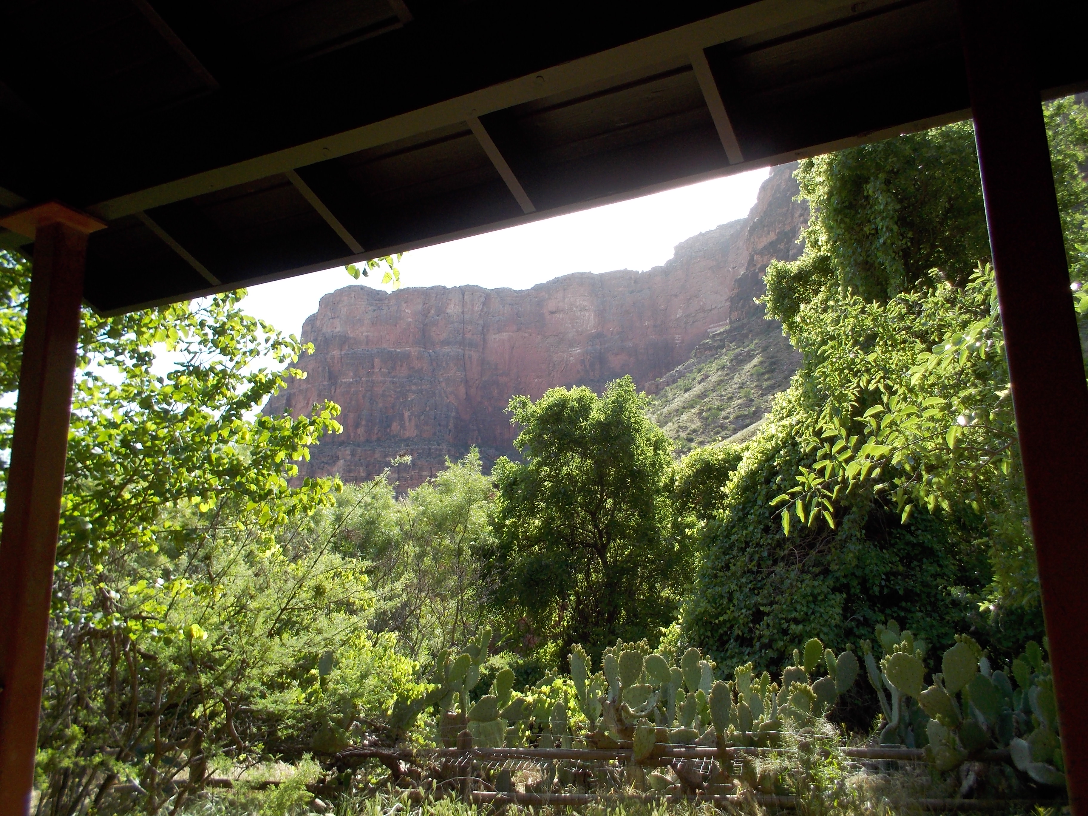
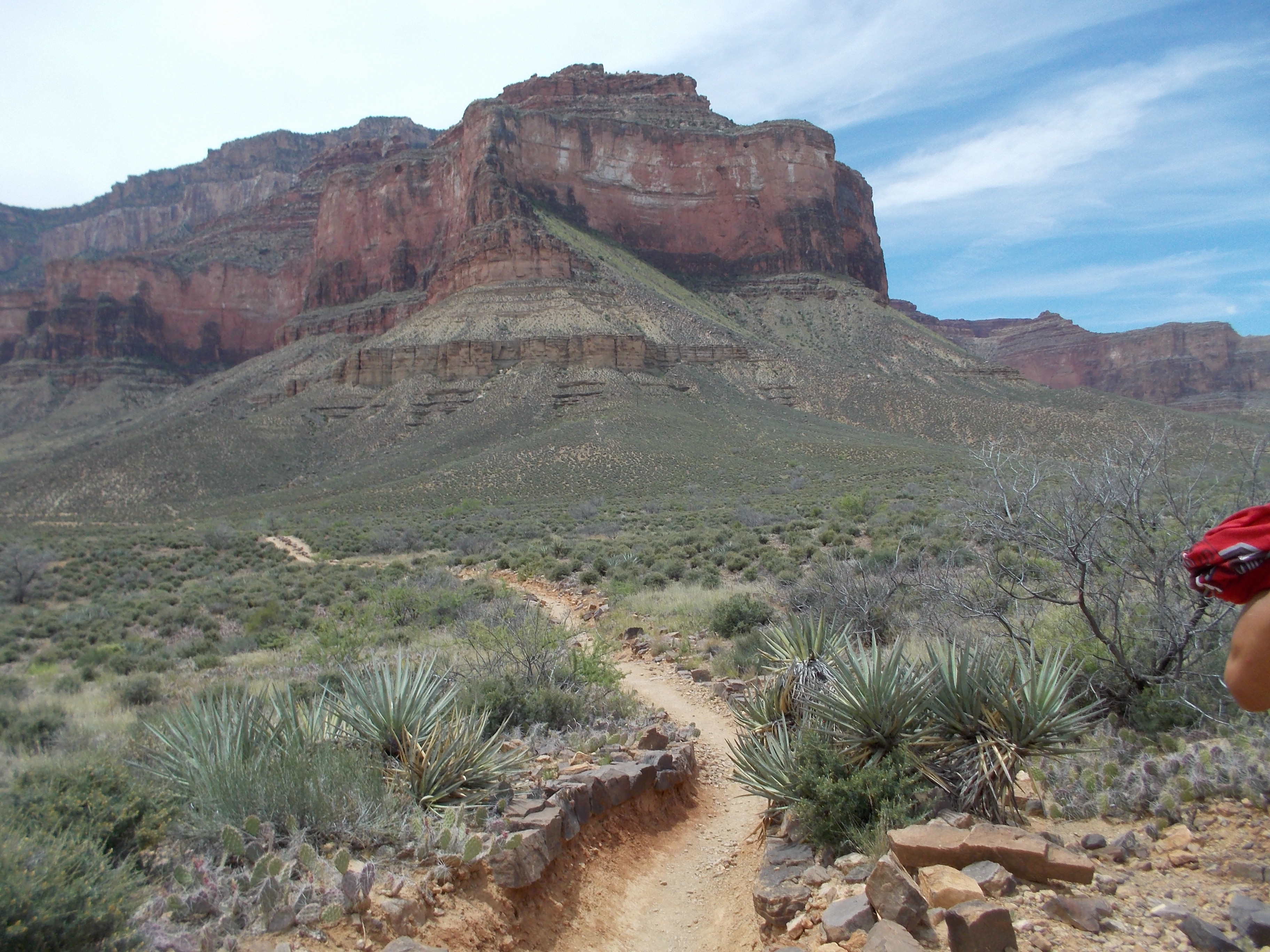
Indian Gardens is a lush oasis halfway down the canyon. It is surrounded by steep vermilion walls. A small creek flows through the campgrounds leaving the trail muddy in spots.

We pitched our tents under a large willow tree. After a nap and lunch, I  was ready to hike to Plateau Point. It was only me and the boys, as everyone else elected to cool off in the creek. The trail to Plateau Point is relatively flat but totally exposed. We were hiking in ninety-degree heat, but without our packs it wasn’t so bad.

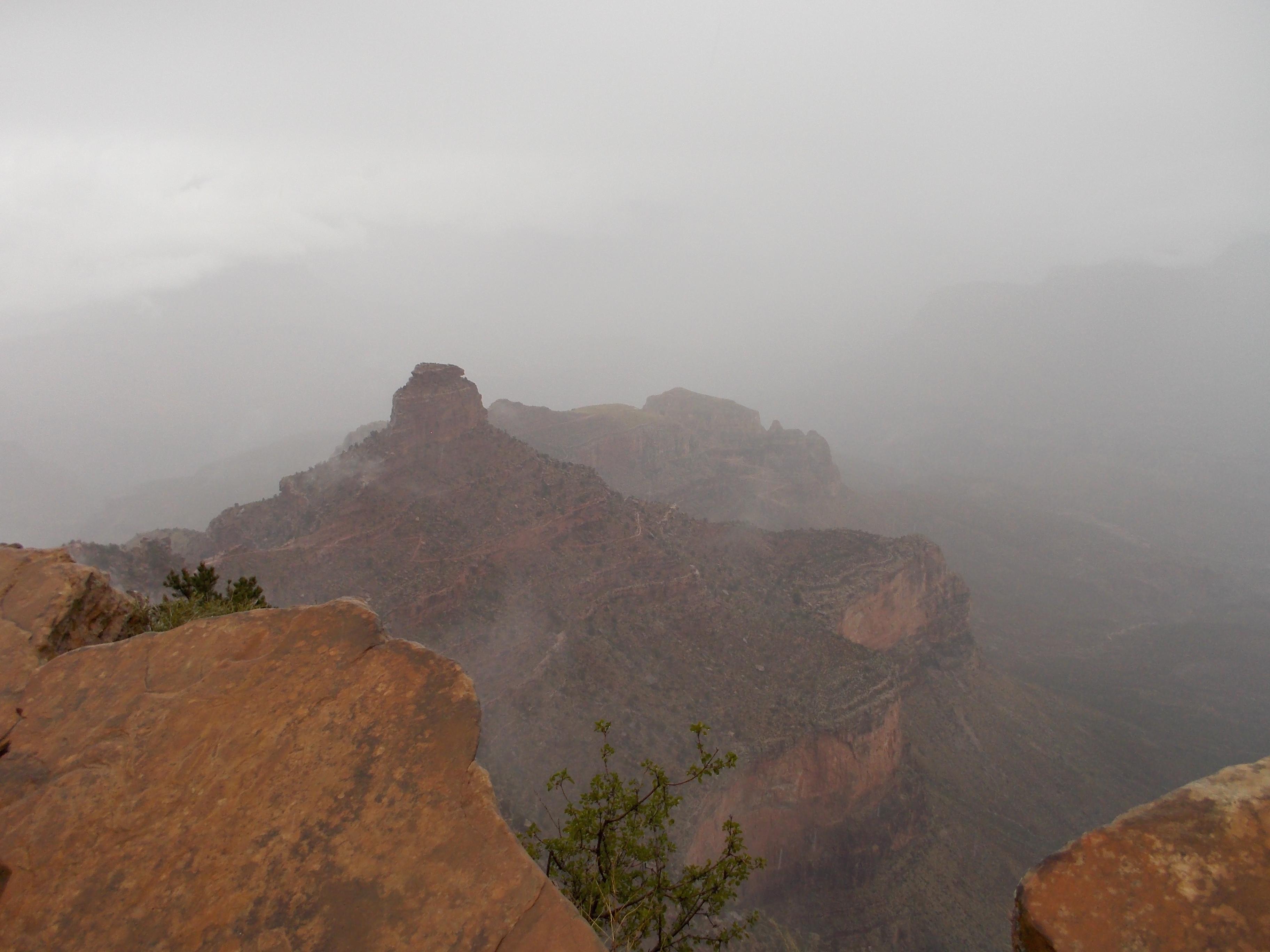
When we reached Plateau Point, we could look down at the Colorado River. From another vantage point, we could see much of the trail we had hike that morning. While we were enjoying the view, we encountered an Asian couple who asked us to take their picture. In return, we asked them to take ours.

As we hiked back, we caught up with the couple. She asked, “Grandma, how old?” I told her that I am sixty-eight. She said that she is sixty-two, but her grandchildren are much smaller than mine.

Back at the camp, a ranger came to tell us that she would be giving a talk in the amphitheater. Mike and I decided to check it out. Had I known the topic–Canyon Night Life–I might have skipped it. As I listened to her talk about the creatures that come out at night, all I could think about was that I would be hiking in the dark. Rattle snakes, skunks, scorpions, big horn sheep, and mountain lions are all out there for me to encounter. The rattle snakes in the canyon are pink. We had already seen one in the campgrounds

Still, I decided to stick with my plan to get up early. After dinner, I got my pack ready and then did my best to sleep in spite of the wind that was trying to carry me away in my tent like Dorothy in the Wizard of Oz. At three o’clock, I was up and getting ready. This time no one else stirred. The entire campgrounds was still except for me scurrying around like a large squirrel.

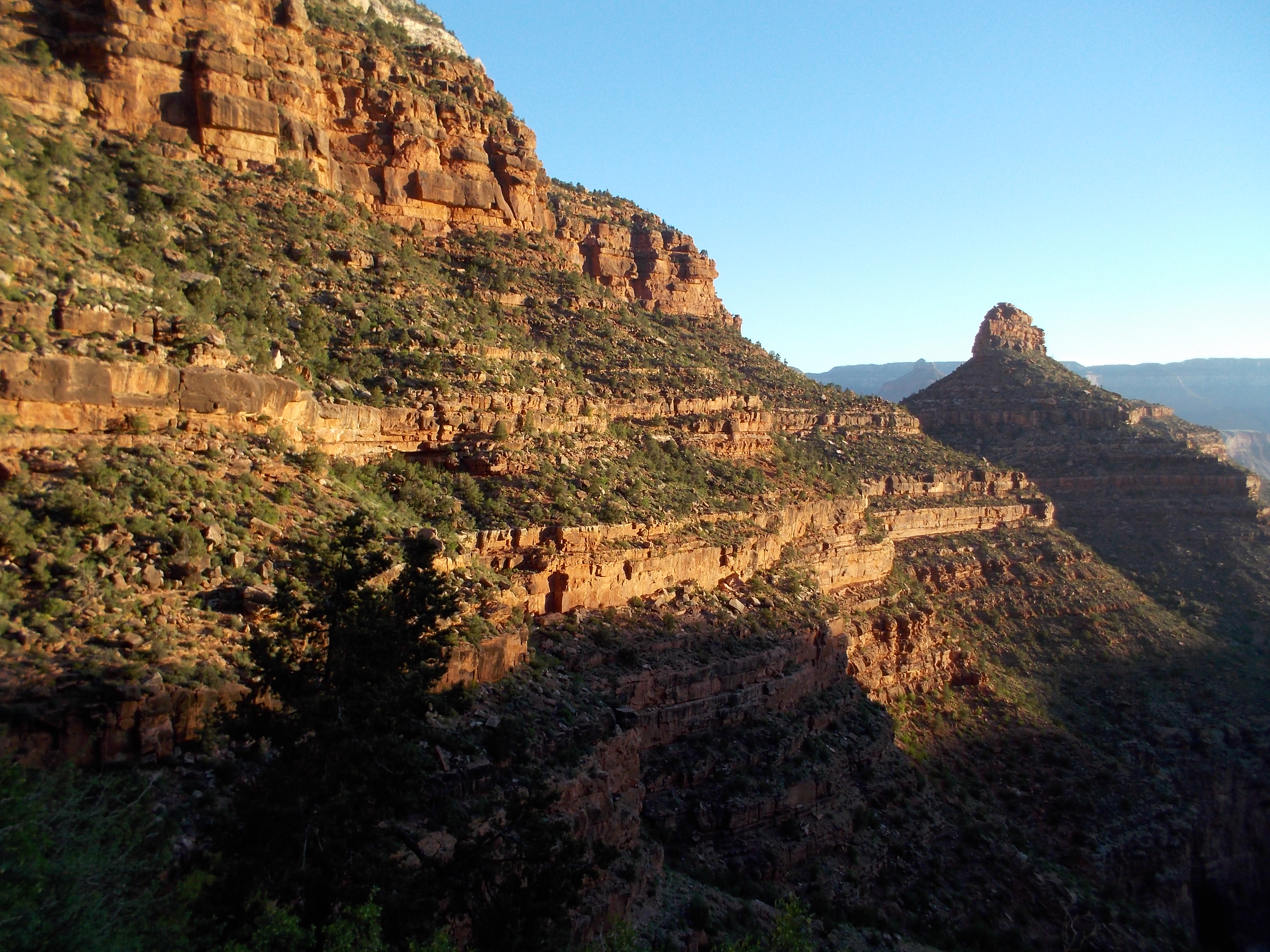
At four o’clock I was hitting the trail and by five I had reached the Three-Mile rest stop. After a brief pause to have a snack, I pressed on. I had passed the One-and-a-half-mile rest stop before I could reach anyone on the radio. Mike and Vikki were the last to break camp and they were on their way out. I had just over a mile to go before reaching the rim. “If you can’t find me, check in the Bright Angel Lodge. I’m going there for breakfast,” I told Mike.

The last part of the trail is the most challenging. Hikers were coming down the trail, but I was the only one going up.  Just as I was nearing the end of the trail, I encountered two rangers. “Where’s my banner and confetti?” I asked. “I’m the first hiker out of the canyon today.” They were impressed that I had hiked out in only four hours. I was elated that I had made it all by myself. As I told Mike I would, I headed for the lodge and ordered a huge breakfast. Real coffee and food that had not previously been freeze-dried was all I could think about.

After breakfast, I still had an hour to wait before the rest of my party began showing up. Loaded in Mike’s truck, we headed for home and a much-deserved rest.

I had done it! I could check this one off my bucket list.  That first night in Bright Angel Campgrounds, Mike told me that if I ever got another one of these hair-brained ideas , they weren’t in. I would like to say that I now have it out of my system, but the truth is I can’t wait to do it all again. Who will go with me? Maybe I’ll go it alone this time. I guess I’ll just have to wait and see.
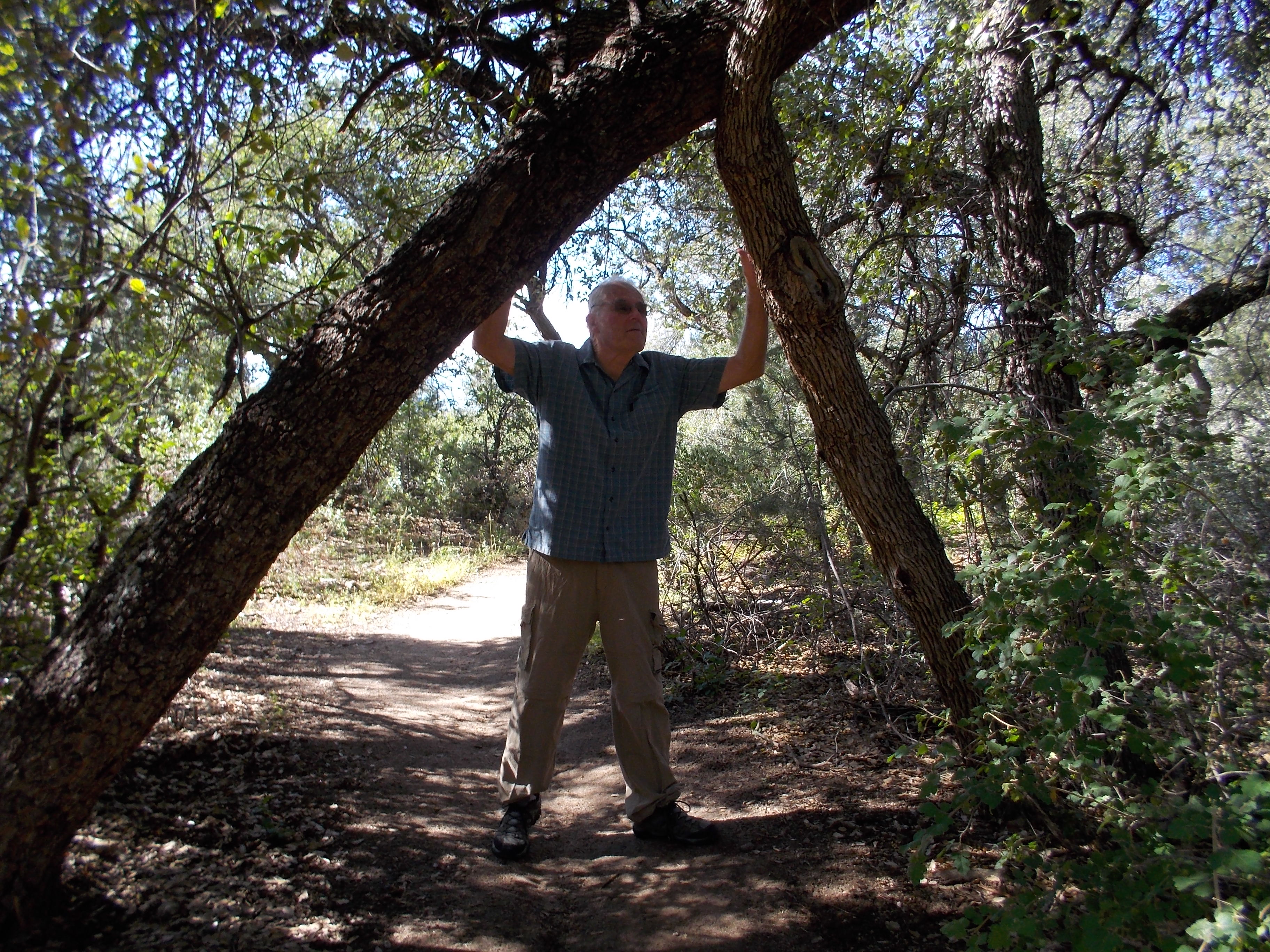
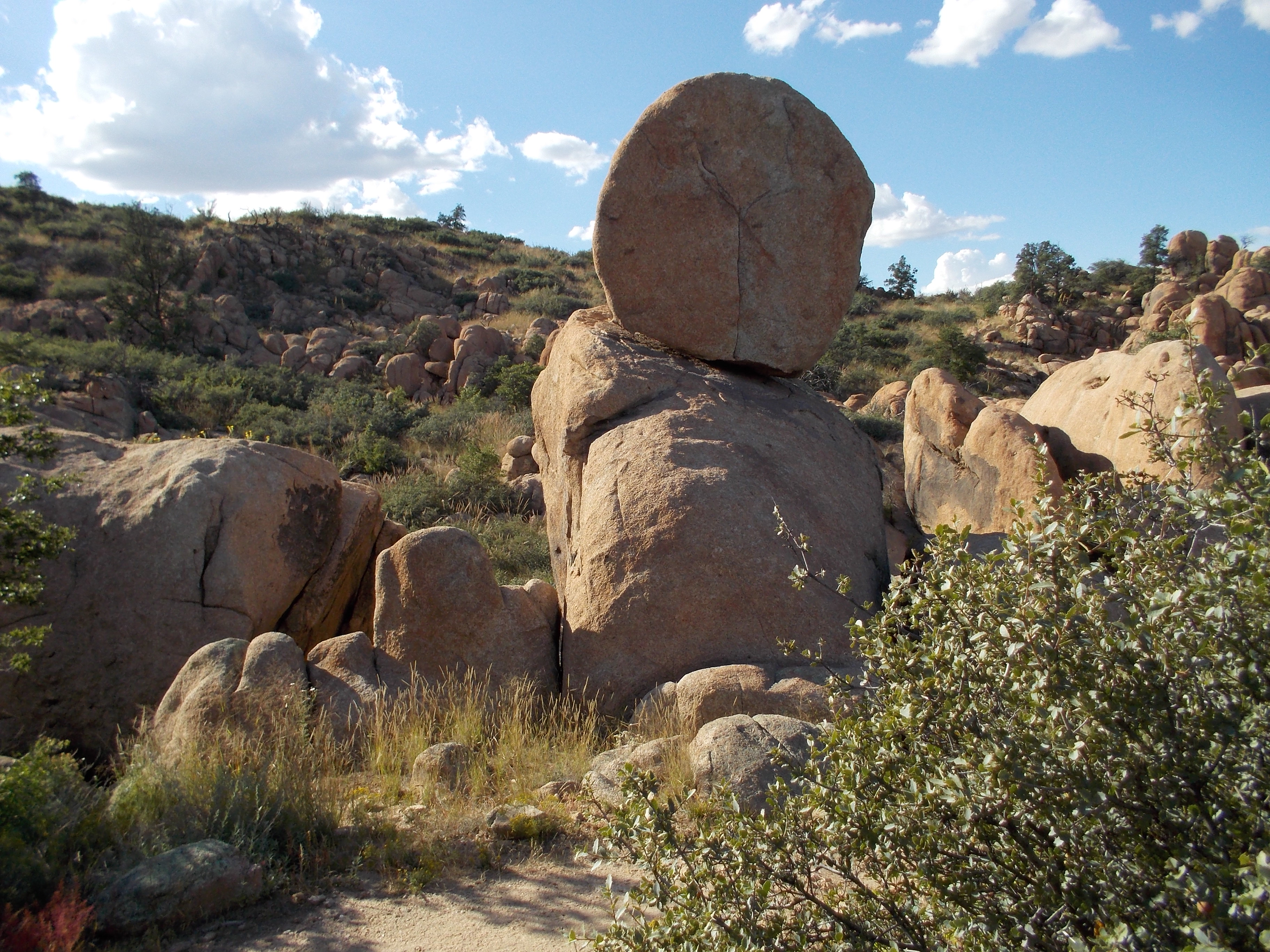
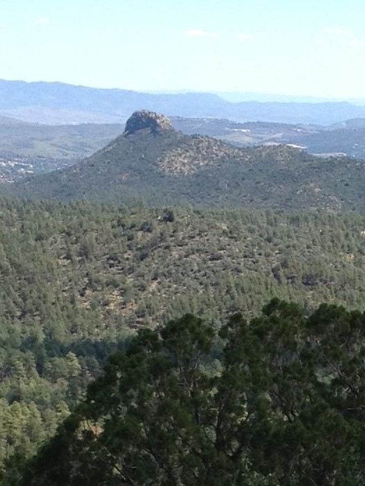
Day 3: Indian Gardens

It was still dark when I emerged from my tent to begin the day. My plan was to be on the trail by five a.m. and if things went well, I would reach Indian Gardens before the heat set in. I tried to make as little noise as possible so I wouldn’t wake the rest of the camp, but before I was ready to leave, Mike and Vikki were up. They wished me “Happy Mother’s Day,” and urged me to be careful. I could tell by the look on Mike’s face that he was concerned about watching his mother walk away from camp alone. But we had all agreed that this was the best idea. The rest of our party would be staggering their start so that there would always be someone coming up behind me in case I needed help. As it turned out, that wasn’t necessary. I was already at Indian Gardens before most of them left camp.

As I hiked down the trail and out of the campgrounds, I felt exhilarated. I was embarking on a great adventure. The nearly full moon lighted my path, making my headlamp almost unnecessary. I hadn’t gone far when I realized there was a large animal on the left side of the trail. It turned out to be a doe, who walked past me close enough that I could have petted her.

Soon I reached Silver Bridge that would take me across the Colorado River. It is a long suspension bridge with a mesh floor that makes the river visible below as you hike across the bridge. The ranger told us that there have been hikers who made it that far and had to turn around because they were too afraid to cross the bridge. I wondered what it would be like crossing in the dark, but it didn’t slow me down at all.

I had hoped to reach the River House, a mile and a half from the campgrounds in an hour, but thirty minutes later, I was there. After another thirty minutes, I found myself at the bottom of Devil’s Corkscrew. Once again, I was attempting the section of the Canyon that had been the most difficult for me hiking in. Only this time, I would be climbing up the Devil’s Corkscrew. Up I went, and to my surprise, it wasn’t difficult at all. The sun made its appearance as I neared to top. I stopped to take a picture as a group of men were coming down the trail. One of them said, “You’re making this look easy.” Another man asked if I would like him to take my picture.

With the biggest challenge over, I stopped at the top for a snack and to put on sun screen. After a brief rest, I was ready to begin again. This time, I would be completing the last leg of the four-and-a-half-mile trail. It had been my hope to reach Indian Gardens by nine o’clock, but it was only seven-thirty when I arrived. After a short rest, I hiked to the campground and located our campsite. Now I just had to wait for everyone else to arrive.

It’s hikin’ time again in Prescott, AZ

dscn0317The 2016 Hiking Spree is underway at the Highlands Center for Natural History. For our third hike, we chose the spectacular Constellation Trail. It is located at the site of the 1959 crash of a Lockheed Constellation. A memorial to the five men who died there can be found atdscn0301 the beginning of the trail as well as pieces of the wreckage.

dscn0302

The trail is west of Highway 89, just south of Highway 89-A. You can park in the lower parking lot at Phippen Museum and use the tunnel to go under Highway 89.  The Constellation is actually made up of small loops inside a large loop. This allows hikers to plan short and long hikes. But you’ll want to allow plenty of time. No matter what my plans, I always end up spending more time than I expect. I get caught up in the wonder of it all.

dscn0304It had rained hard the day before leaving water along the way, but most of the trail was dry.  We began our hike on the North 40, which goes along the base of the large granite formations. Then we took a newly added loop called Ham and Cheese. The trail wove through the granite rocks as if they were made of Swiss cheese, making us feel like we were part of the sandwich–Does that mean the hikers are the ham?dscn0310 Next we took a trail called the Hully Gully. A walk across the face of granite rocks (the Hully) led us to a flower-lined gully.  Our next leg of the hike was the Lost Wall. This part was steeper than the other parts of our hike. I was envious of the lizards that made it seem so easy to go  up the granite boulders. But then they do have four feet instead of two and a much lower center of gravity.

dscn0318The lost wall is part of what was probably a sheep pen,  built more than one hundred years ago.  We skipped the Hole in the Wall loop that goes steeply up through a crack between the rocks. We have done that trail before and it is a fun one. Returning back to the trailhead via the Rock Wall Trail, we were treated to picturesque views of the Dells along with unbelievable rock formations.dscn0322

I hope you have the opportunity to explore this amazing trail. Don’t rush–You’ll want to stop often to enjoy the scenery that makes hiking the Granite Dells a unique experience.


My not-so-grand canyon trip

DSCN0147I had been attuned to the weather like a sailor for weeks. The much anticipated morning arrived drizzly and gray. But it was my hope that in true Arizona fashion, the sun would melt away the clouds and leave a cool, clear day for our hike.

Driving to the Canyon, a fine mist covered our windshield. By the time we reached the Backcountry Office, the rain forced us inside to finish getting our gear ready.  It would require two bus trips to get to the trailhead since we had missed the last Backpackers Express.

The rain had stopped by the time we reached the trailhead.   The canyon was filled with clouds which was a rare treat for me. But I couldn’t help feeling sorry for first-time visitors who only had that one day to spend at the canyon. They were going to miss the spectacular views that attract people from around the world.

We had gone down several of the switchbacks at the beginning of DSCN0148the South Kaibab Trail when I noticed that Craig did not have his walking sticks. Our son, Mike, had seen some walking sticks leaning against the restroom at the trailhead. He offered to go back and see if they were still there. In the meantime, the rest of our party pressed on down the trail.

After the switchbacks, the trail became rougher and was at a more severe decline. To make matter worse, large pools of water had collected behind little rock dams all along the trail. Mike caught up with us again–without Craig’s walking sticks.

DSCN0150In spite of the weather and the sporadic showers, I was enjoying the hike, stopping occasionally to take a picture. It was at one of those stops, about one and a half miles down, that I looked back to find Craig flanked by Mike and his wife, Vikki. Craig was walking slowly, stumbling at times, and occasionally getting dangerously close to the edge. It was apparent to everyone in our party as well as perfect strangers hiking near us, that Craig was not capable of  safely finishing the remaining five miles let alone the nearly ten-mile hike that would be necessary to leave the canyon on Monday. There was nothing to do but help him get back to the rim. Mike went part of the way with us, carrying Craig’s pack. Once we reached the switchbacks, he left us and returned to finish the descent.

Craig and I made our way slowly up the switchbacks that had DSCN0149seemed so easy to climb down. Once we reached the rim, we rested for a few minutes and then boarded the first of the two buses for the return trip to our car. On the second bus, I was chatting with some other passengers about our experience. I had just told them that Craig had lost his walking sticks, when I realized I no longer had my sticks either. I had left them on the previous bus. The bus driver used his radio to determine that my sticks were on bus 6. I would have to reconnect with bus 6 in order to get them back.

Reaching our car, we threw our packs into the trunk and walked to the Bright Angel Lodge. There was no need to eat the peanut butter and jelly sandwiches I had packed for our lunch. Cold, wet and tired, we were going to enjoy a nice hot meal before going home.  We spent the afternoon retrieving our walking sticks–Craig’s from the Backcountry Office and mine from Bus 6.  While we were waiting for Bus 6 to return to the Visitors Center, it began to snow. In the ten minutes we were away, our car was totally covered with the white stuff. It was necessary to run the defroster for a while before it was safe to drive.  Later, we would pass a snow plow headed for the canyon.

On our drive home in the rain, I contemplated whether we were ready to check in to the Las Fuentes Senior Home. But during the two-hour drive, I concocted a new plan to conquer the canyon. This one is much less ambitious than my original plan. It involves camping at Indian Gardens, which is only 4.5 miles down the Bright Angel Trail. Having some of my gear brought down on a mule is also under consideration. I’m not sure who will go with me–maybe some friends or my grandkids. Sadly, Craig’s canyon hiking days are over.


Getting Ready to Hike the Canyon (It only took 67 years.)

grand canyon 20I retired three years ago. It seems to me that one of the purposes of retirement is to fill in the blanks of our lives–to do those things we were too busy to do during our careers. That’s why we make that requisite “bucket list.”

Having lived my entire life in Arizona, and being a avid hiker, I am embarrassed to admit that I have never been to the bottom of the Grand Canyon. About twelve years ago, Craig and I hiked down Bright Angel Trail to Plateau Point. It was a grueling nine-hour hike to complete the twelve miles in and out in one day.  Getting down was fairly easy, but the climb back up was exhausting. When we reached the rim I told Craig that we had to go directly to the lodge and eat dinner. I knew that once I got to our room I would not leave it until morning.

Surprisingly,  we are better prepared to hike the Canyon today than we were back then.  Busy with work, we had little time to hike on a regular basis. The only real planning we did for that trip was making reservations at the lodge.  Now that we are retired, we walk a two-mile route near our home almost every day. Once a week, we try to take a longer (4-7 mile hike). To get ready for this trek, we have been going on even  longer hikes up steeper elevations.

My biggest concern is carrying the gear, as we will be camping for two nights at Bright Angel Campground. Some thirty years ago, we went on backpacking trips with our son’s Boy Scout Troop. I recall being loaded down with heavy packs and hiking ten or twelve miles into the wilderness behind a gaggle of chattering scouts. Craig and I usually arrived first at the campsite. The boys took frequent breaks and I liked to keep going–not because I had more stamina, but because stopping meant taking off the pack and I wasn’t sure I would want to put it back on. It was better for me to just keep going.

Last summer Craig and I found a terrific deal on camping  backpacks at Costco. Apparently that was the impetus I needed to plan a hiking trip into the Canyon. The difficulty of getting a permit was an excuse I often used. Oddly enough, I was successful at getting  one on my first try.

One of the advantages of waiting so long to attempt this hike is that the equipment we need is better made, cheaper and more light-weight than it was thirty years ago. Back then, backpacks were huge monstrosities with frames for attaching sleeping bags and tents. Backpacking gear was horribly expensive.  We rented packs from the Hike Shack until we were able to purchase some used ones. Everything from tents to sleeping bags was heavy and bulky.  I suppose we have the space program to thank for the wonderful options we have today.

We were able to completely outfit our trip at Walmart.  There we   DSCN0142 (1)found sleeping bags that weigh less than two pounds and a two-person tent that weighs five. We bought everything we need for about $150. It all fit efficiently into our packs and we’ll be carrying less than thirty pounds on our backs.

With our packs loaded we went to a nearby trail and walked a four-mile circle. Everything went smoothly. Amazingly, I could hardly notice the weight. That’s because my pack is ergonomically designed to put the weight on my hips–not my back and shoulders.  I am feeling optimistic about the undertaking. I’ll let you know in a future post just how it went–complete with pictures, of course.

Winter Hiking in Prescott, AZ

IMG_0518Winter is a special time for hiking in Prescott. Cooler temperatures allow longer, less sheltered hikes. Sunny days with temperatures in the upper forties to upper fifties are best, but I’ve hiked when temps were in the thirties.  You soon warm up as you hike along.

Snow creates its own challenges. Recently we hiked the Centennial trail. It is named for the Arizona Centennial and was opened in 2012. We hiked it in September of that year. It was beautiful with flowers still in bloom. This time we hiked it after a snow. The beginning of the trail was muddy, but there were plenty of boulders on both sides of the trail. In most cases we were able to step on the boulders and avoid the mud. As we came around to the north side, the trail was still covered with snow. Making our way up the north face, we tramped through snow most of the way. The snow had melted in some places, leaving  very gooey mud.  In other places it had refrozen into slippery ice flows. At various spots along  the trail we had to cross small streams. Again, strategically-placed boulders provided a way across.IMG_0522

After our climb, we descended into a secluded valley–very mystical and delightful.  After climbing out of the valley–on snow-packed trails of course– we were treated to petroglyphs and magnificent homes in Enchanted Canyon. You can reach this trail off of Gail Gardner Way. Turn onto Westridge and go about a half mile. There is a small parking lot on the right. Then walk along Westridge for about 100 yards to the trailhead.

To avoid the snow and mud, we have elected to hike the trails along Pioneer Parkway and Williamson Valley Road. Many of the trails in that area are part of the Circle Trail that goes all the way around Prescott. You can begin the Legacy trail at Kuebler Field just off of Commerce Drive. Vegetation is sparse in places which makes it great for winter hiking. The trail goes under Pioneer Parkway three times by way of nicely lighted underpasses. There are great views of the Granite Dells, Granit Mountain and Glassford Hill. You can also begin this trail off of Williamson Valley Road. There is a small parking area on the east side of the road just after the intersection with Pioneer Parkway.

IMG_0521The trails around Watson and Willow Lakes are also good choices for winter hikes. Most of the time you will be walking on boulders, and snow melts away quickly there. We usually try to avoid the trails off Walker Road or Senator Highway after a snow, but otherwise they are also good for winter hiking on warmer days.

The important thing is to get out there and hike. Spring is just around the corner and you’ll be ready as the snows melt up north and the flowers begin to bloom.

The Highland Center for Natural History–Something for Everyone

IMG_0461Visitors who come to Prescott and those moving here, may be fortunate enough to discover one is our greatest treasures–The Highland Center for Natural History. Located a short drive down Walker Road from Highway 69 (by Costco) the Highland Center offers something for everyone.

My husband and I first came to the Highland Center because we were looking to add some more physical activity to our lives.  In September of 2008, the Highland Center began the Hiking Spree. Participants are provided with maps for a dozen hikes in the Prescott National Forest. The requirement is to complete eight of the hikes. This entitles the participants to purchase an emblem appropriate to put on a wooden walking stick (Which you can also purchase at the Highland Center). Craig and I have completed the Hiking Spree every year.  We are just three hikes away from earning our 2015 emblem.

In 2008, I was still teaching at Bradshaw Mountain High School, but I considered volunteering at the Highland Center once I retired. As retirement came closer, I put volunteering on my bucket list. For the past two years, I have been a docent for second and fourth graders who come to the Highland Center on school field trips. I have learned a lot from the docent training, but I also learn a lot from the kids. I love their enthusiasm and curiosity. Sharing my love of the outdoors with them has brought me many hours of enjoyment.

The Highland Center has much to offer. Besides the school programs for second and fourth graders, there are programs for preschool, kindergarten and seventh grade. During school breaks children can enroll in day camps where they become even more immersed in learning about our special Central Highland ecosystem.

Families come to the Highland Center to enjoy the many hiking trails. The trails connect with other places in the Prescott National Forest, such as Lynx Lake and the Lynx Creek Ruins. Throughout the year, there are programs for families. Bug-a-Boo Bliss is an opportunity to take a look at our tiniest creatures. Imagine studying specimens of insects or even holding and petting large cockroaches, or taking a hike at dusk with a guide who knows just where to look for bugs and spiders. At Halloween Happenings, families can participate in scavenger hunts, crafts, and fireside stories.

For adults the Highland Center offers many educational opportunities. There are guided hikes, bird walks and interesting classes. Whether you just want to know a little about our beautiful home or you are serious about becoming a certified naturalist, you’ll find what you’re looking for at the Highland Center.